Flow trail action for young and old on the Simonhöhe
In winter, the Simonhöhe is a paradise for skiing fans and winter hikers. But there is also action and fun for the whole family on the Simonhöhe in summer with the new family-friendly flow trails. The ambitious bikers and you are transported by the Bärental T-bar lift.
By bus to the bike Eldorado
From now on, the bike bus will take guests and locals to the Simonhöhe in comfort and safety every Friday from May 18, 2024 to June 30, 2024. To make the journey to the Simonhöhe even more relaxed, the Central Carinthia tourism region is organizing the bike bus this year, which will transport passengers to the Simonhöhe for just 8 Euro per ride (5 Euro for holders of the Wörthersee PLUS Card) excl. lift ticket up and down again. Registration is required by 11:00 a.m. on the Wednesday before by e-mail to info@mittelkaernten.at or by telephone on +43(0)4212 45608.
Departure is at 8:30 a.m. at the train station in St. Veit an der Glan, further boarding points along the route are possible. The return is at 15:00 at the valley station on the Simonhöhe.
Book now
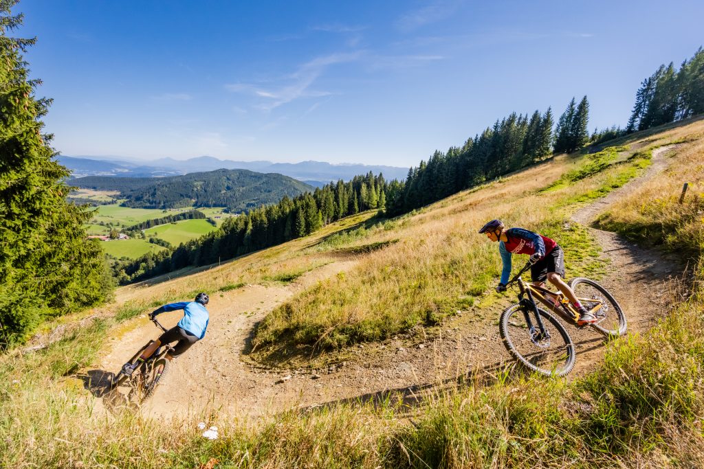
Simon’s Flow Trail for families & exercise area for children
Simon’s Flowtrail starts at the summit of the Hocheck and is 2.2 km long. There are 185 meters of altitude to conquer and is easily manageable for the whole family.
At the Hocheck valley station there is a children’s and practice area with four learning trails, an uphill trail and a magic carpet. Children from the age of 2.5 can let off steam here.
All flow trails on the Simonhöhe at a glance:
Length: 2.2 km
Elevation gain: 185 m
Difficulty level: easy, basic trail technique required
Length: 0.6 km
Elevation gain: 65 m
Difficulty level: moderately difficult, good trail and jumping technique required
Length: 110 m
Elevation gain: 11 m
Difficulty level: moderately difficult
Length: 130 m
Elevation gain: 10 m
Difficulty level: easy, suitable for small children from 4 years of age
Length: 50 m
Elevation gain: 4 m
Difficulty level: moderate to difficult
Length: 95 m
Elevation gain: 9 m
Difficulty level: moderately difficult
Length: 160 m
Elevation gain: 10 m
Difficulty: easy
Here you get to the overview map